


By: Matt Setlack
On Wednesday 29 August 2018, my wife, Emily and I decided to run over the course in preparation for the upcoming World Mountain Running Championships (WMRC) in Canillo, Andorra on 16 September 2018. I have competed in WMRC Bulgaria 2016 and WMRC Italy 2017. This will be Emily's first time competing in WMRC.
We re-ran over various sections of the race course on 10, 11 and 12 September 2018. As of 12 September 2018, the race course has been officially marked with red triangular flags and red/white flagging tape.
References
Race website at https://www.wmrch2018canillo.com/en/courses/
Another course check that was done by Timo Zeiler at https://timozeiler.com/2018/06/16/andorra-world-mountainrunning-championships-course-check/
Course Description
From the race website, "The Senior route starts in front of the Canillo Parish Hall (Edifici del Comú de Canillo) and continues along a 1.3 km stretch of tarmac with an average gradient of 7%. It then switches to a mountain path combined with a forest trail. Runners then pass by a man-made lake and reach the mid-point (4,720 metres from the start) at an altitude of 2,050 metres (feed stop 1).
Here, the route dips down for a short while to the 5.8 km mark, following a trail into the woods with a number of small rises (but little elevation gain) until it reaches the Ribaescorxada refuge 9.2 km into the run (feed stop 2).
It is uphill on paths from here on until the 11-km mark, followed by a last flat section with a small rise to an altitude of 2,430 some 11.93 kilometres into the run (finish at Forn de Canillo chairlift)."
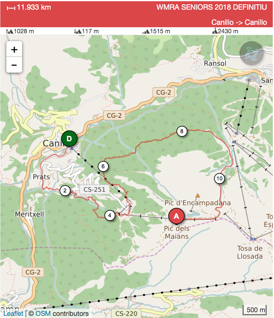
Course Map
Click on the map below to be directed to the https://www.openrunner.com/r/8038564 website.
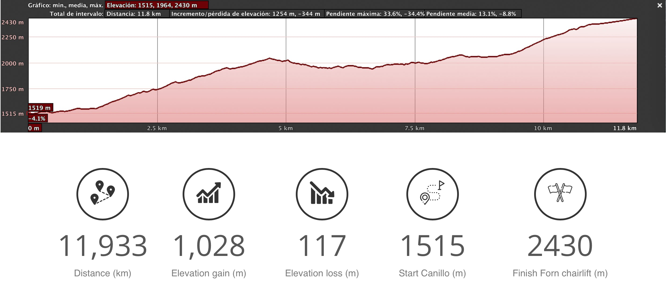
Elevation Profile
Accessing the Race Course
By Gondola - There is a cable car/gondola that starts right near the start of the race and ends at the "mid-point". The mid-point is 4,720m from the start. I have not personally taken the gondola before but info on it can be found here: http://ww2.grandvalira.com/en/mont-magic-canillo.
By Car - Another option is to drive almost all the way up to the mid-point. There is a paved road called Ctra. de Prats/CS-250, which then turns into Ctra. del Forn. It is the one that we run on for the first 1.3k of the race that you can drive on. Instead of turning off this paved road around the 1k mark, keep driving on it all the way until the pavement ends. You can park your car and then walk up a gravel road for 700m or so to the mid-point. Once you pass under the chairlift, you should see some red flags going up the grass slope towards the blue arches/hoops.
Course Photos

The red line represents the approximate race course. I took this photo from Mirador Roc Del Quer looking SE. I drew the red line myself and it is not perfect but does represent the approximate route.
The following photos were taken by Matt Setlack. The perspective of all photos is from the point of view of the runner running the race. I believe that the photos I took make the course look less technical and less steep than it actually is. It is steeper than it looks. I would not underestimate the course. I think there are some sections where walking may be necessary such as the area just before the "mid-section" and in the area about 500m past the refuge.
Compared to WMRC Bulgaria 2016 (1,380m up over 12.7km), WMRC Andorra 2018 (1,028m up over 11.7km) does appear to be more runnable. I personally prefer the Andorra course over the Bulgaria course and I think the finish times will be fast.
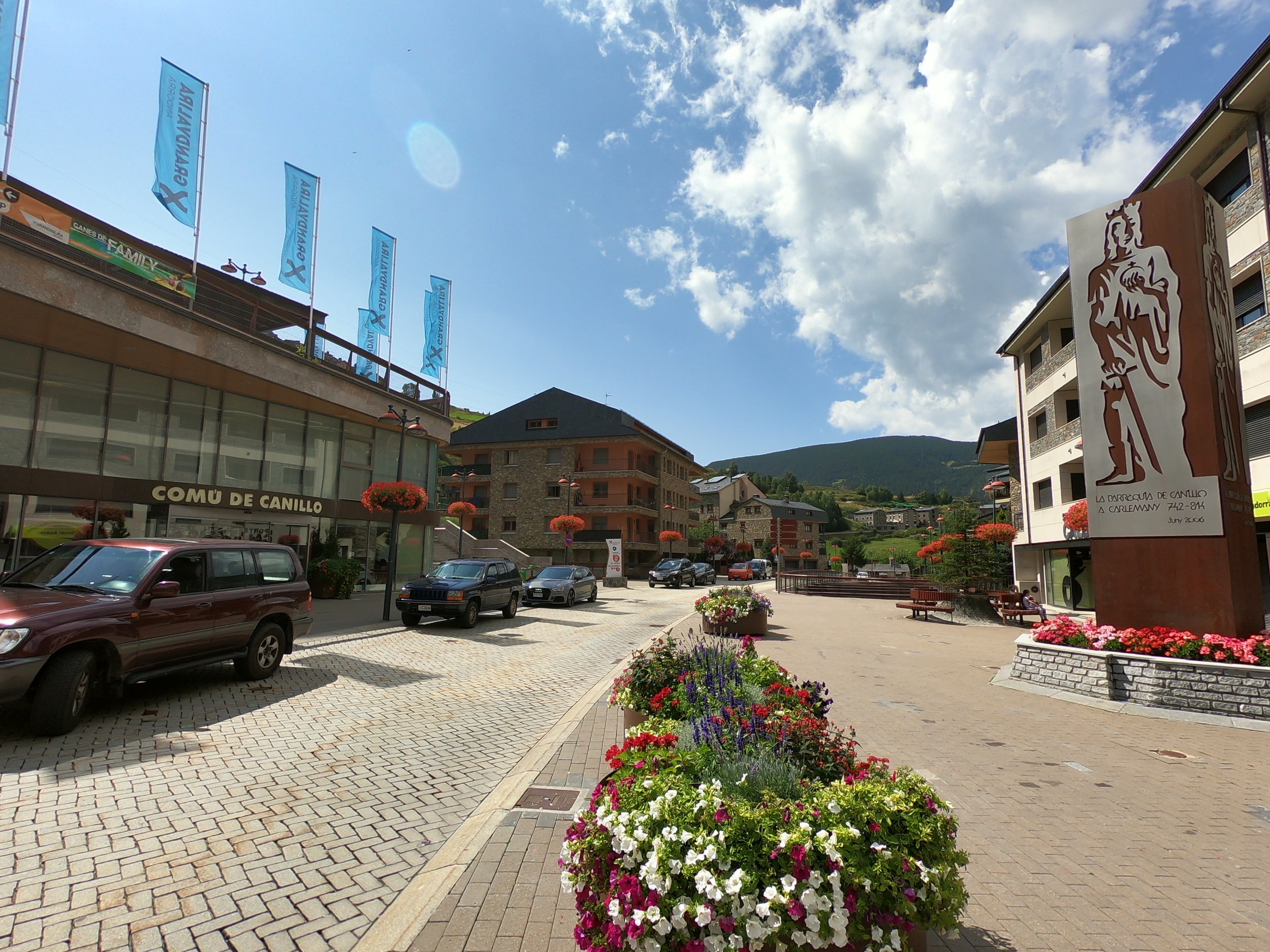
Start area in front of the Comu de Canillo.

This is the topographical map (scale 1:40,000, which was not ideal) I used. In the future, I plan to use a GPS track and/or mobile phone with data to determine exactly where the course went the first time. Before the race course was officially marked, there were various sections that were not straightforward and without a GPS, would be extremely difficult to determine correctly.

The first 100m are on bricks before the route turns to asphalt.

After about 100m, you make a left turn (where you see the blue "P" (for parking) sign in this photo)

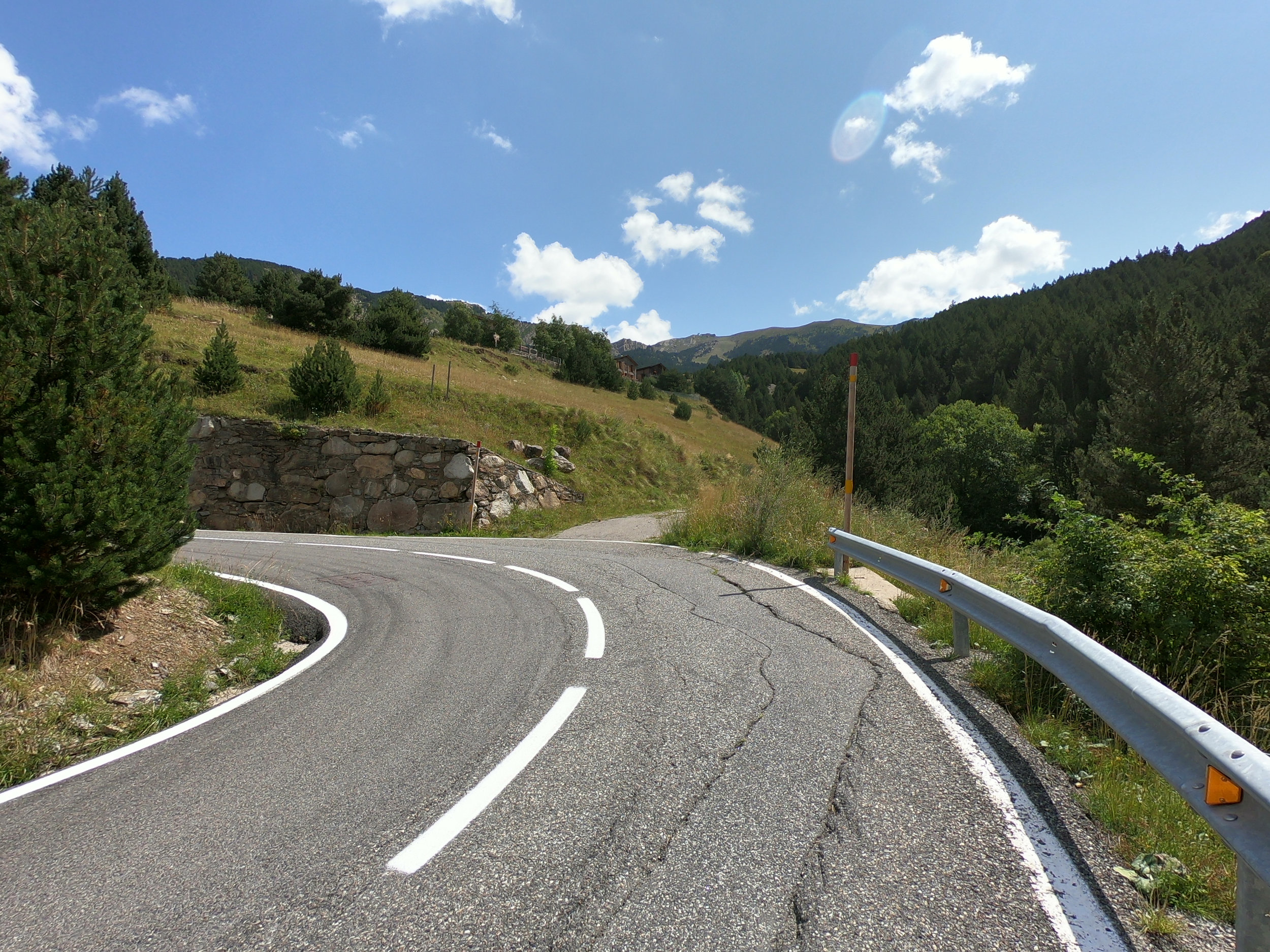
This is right next to that blue "P" (for parking) sign. You head up this road for another 1.1 km. From the course start, the asphalt/tarmac section is 1.3 km.

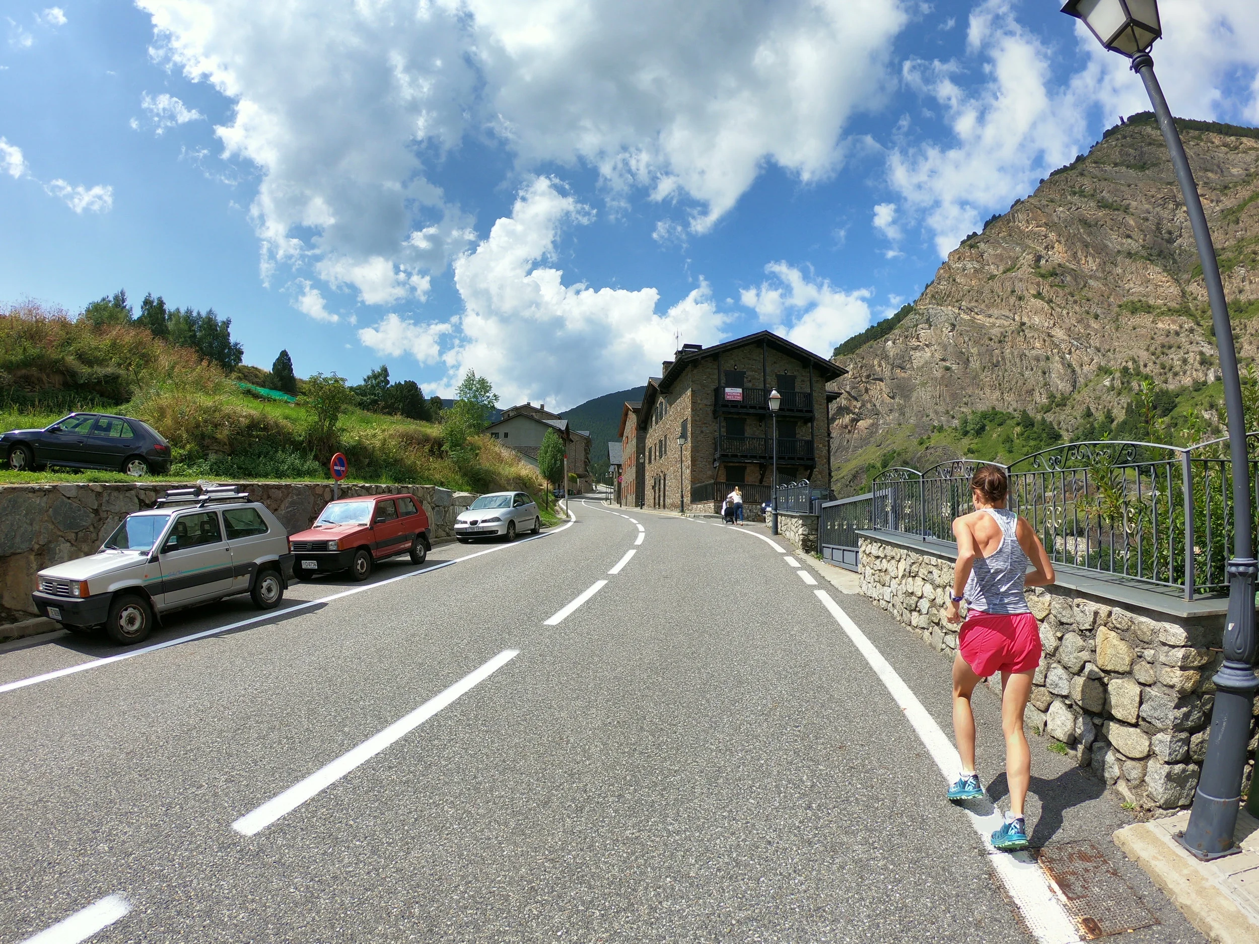
Emily (in pink shorts) running on the asphalt section. The first 1.3 km are a steady uphill (average gradient of 7%).
More tarmac.

More tarmac.

The white RV is pointing in the direction that the course goes. You make a right turn off the main road. This is just before 1 km into the race. There is a gentle downhill here.

Emily is about 1 km into the race here.

The race goes through the village of Prats. I'm pretty sure there will not be cars parked on the side of the road on race day.

The white truck is parked at a fork in the road. The race takes the left fork and from there you go another 100m or so to reach the start of the trail portion.

Taking the left fork.

This is the very start of the forest trail portion. There is a red bunny rabbit marking the trail (seen on the sign on the right). The route goes up and to the left behind the building.

This photo was taken just past the red bunny rabbit sign (seen above). The route goes up and to the right. There are wooden steps that are staked into the earth with steel stakes (concrete rebar), which protrude from the stakes a bit in a few areas.

Taken at a T-intersection. You go straight through the intersection, following the red bunny rabbit sign.

Following the red bunny rabbit.

The course map shows the route going to the right here. This is about 2 km into the race.

On one of three switchbacks before getting to the paved road.

Come out (running towards the camera) on the gravel road on the right, turn right and go up the paved road for about 50m.
Run up the paved road for about 50m and turn right on the gravel road on the right.

After the first creek/river crossing, run up a gravel road and turn left on the narrow single track path.
Take the left fork and go up a steep single track.

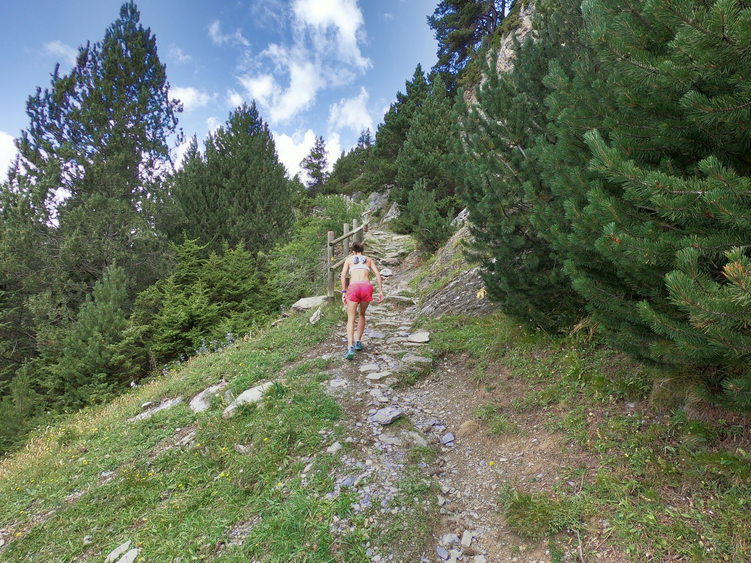
One of the steepest sections of the entire race course. Approximately 2.6 km into the race.

Crossing back over the stream/river for the second time.

Gravel road (ski run in winter). This is about 3 km into the race.

The gravel road is nice and smooth in this area but changes to rougher rock/gravel later on.

The rock is a little rougher here.

Just before getting to the man-made lake, where the blue flag is.

This is the man-made lake at 4 km into the race. The race map shows us going around the left hand side (over the wooden boards in this photo). HOWEVER, as of 15 September 2018, the actual race route has been marked with red/white flagging tape and the route goes around the RIGHT hand side of the lake (NOT the left hand side of the lake).

The path is to climber’s right of this gravel path.

This is just past what the race website refers to as the "mid-point" of the race (4,720m from the start and 2,050m elevation (feed stop 1)). I believe we run through the blue arches. You are aiming for the bottom of the tube and running just beneath the gondola in this photo. The course is downhill from here to the 5.8 km point.

This is just beneath the gondola where you enter the forest. More downhill.

You pass by a horse display (where the three people are standing) and then run a few switch-backs downhill.
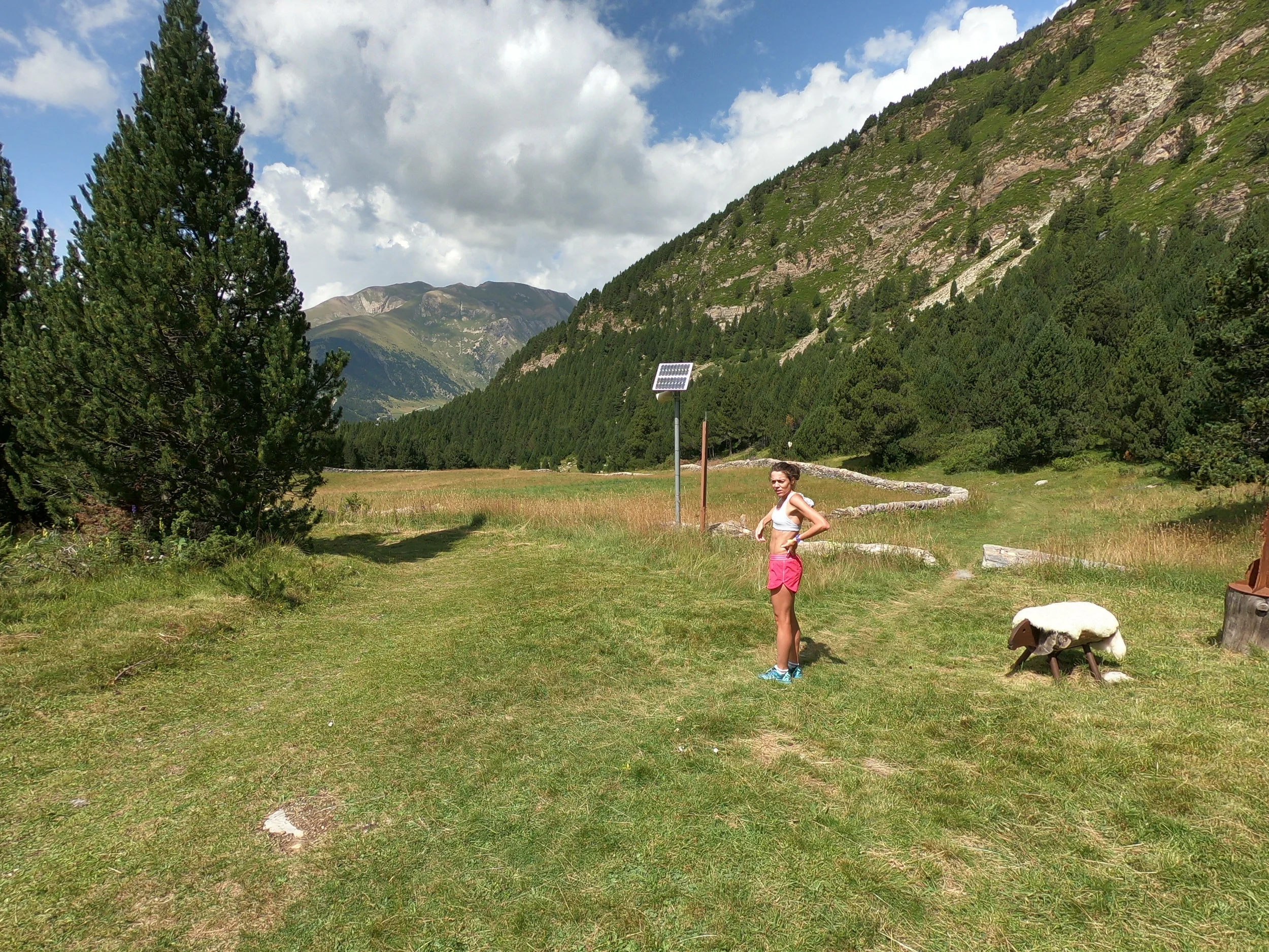
You get to an open meadow, which you run around the right side (along the stone fence). The small opening between the logs (next to the sheep display) has a black arrow on it. The meadow is just past 5 km into the race.

The opening between the logs. I believe the black x's mark the WMRC route. I also saw blue circles, red circles, yellow circles, orange circles and grey metal poles but I don't think those are for our race.
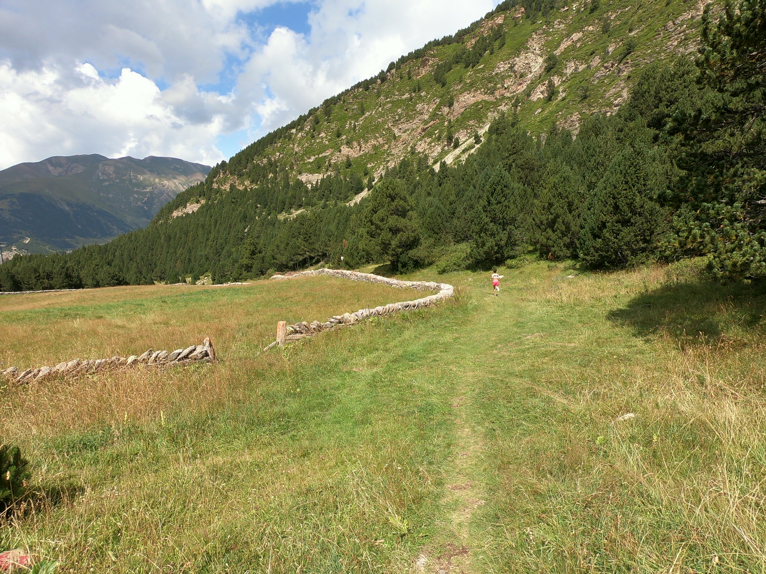
Following the stone fence around the meadow. This section is still downhill on grass and some rocks.

More meadow.

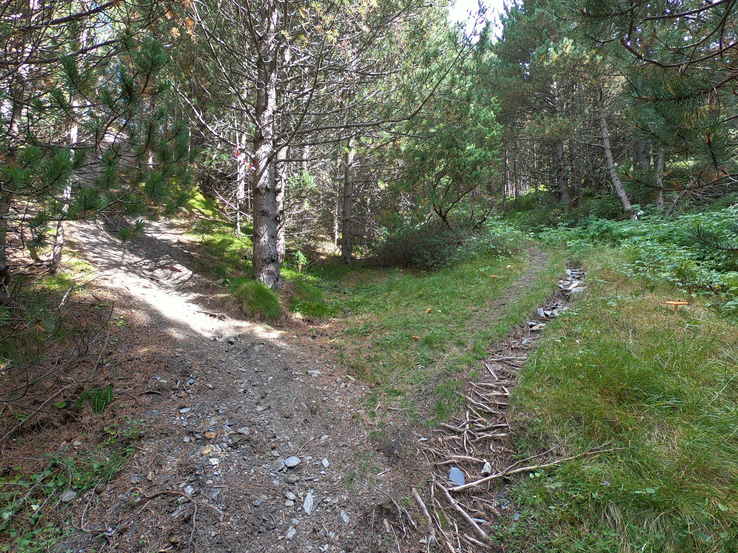
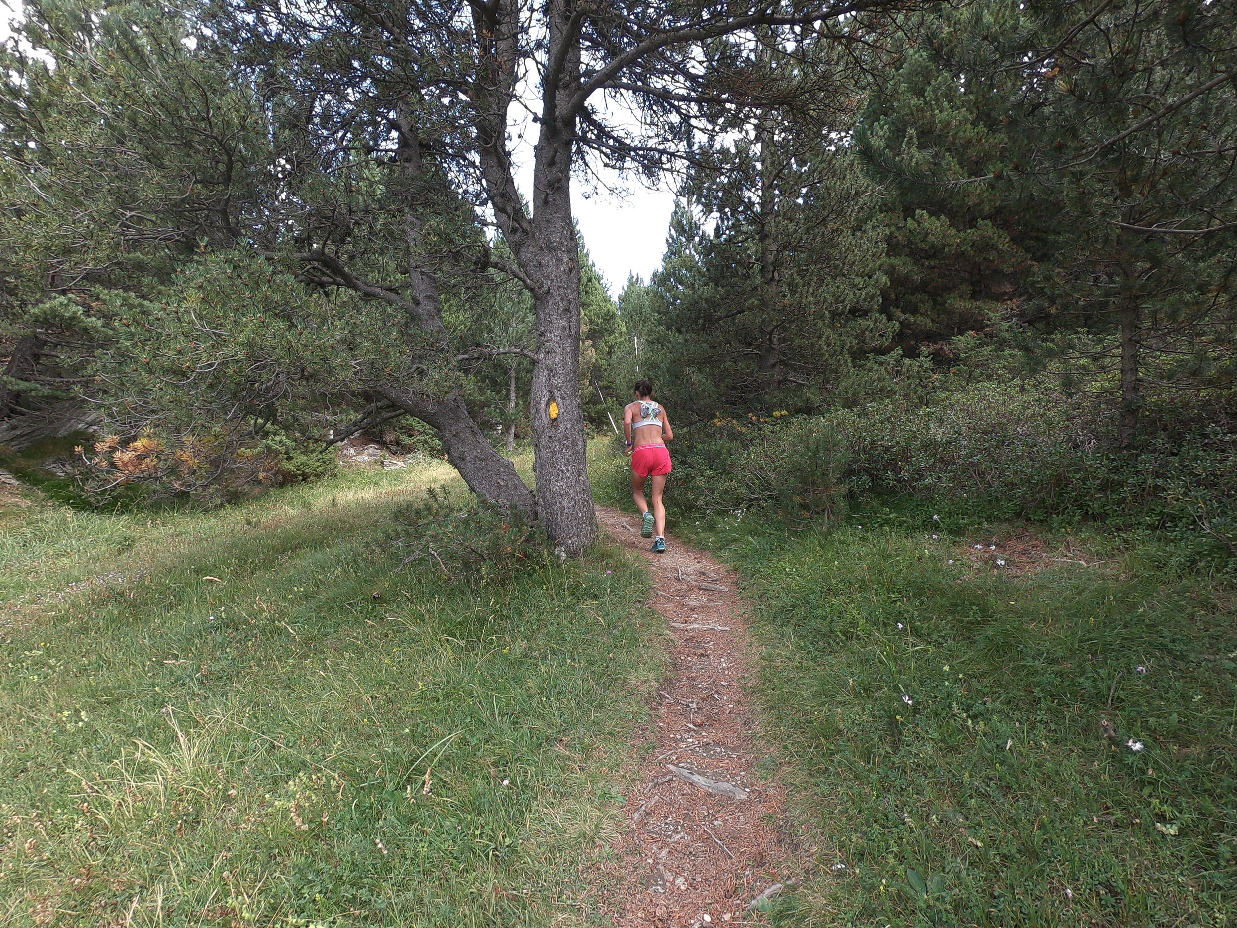
The start of the single track. Mostly dirt with some rock and some grass. From about km 5 to km 9, the single track trail traverses around the mountain to another ski resort. From km 5.8 to km 9, the course is relatively flat with some small up and downs.

More single track, still going downhill.

Passing beneath the gondola still going downhill. Where this photo was taken, there are wooden steps going up and to the right just beneath the gondola; do not take these steps. I'm quite sure that the course will be really well marked on race day though.
One of the uphill sections.

I am not sure what the yellow, red and blue paint is for.

Typical terrain from km 5 to km 9.

Some sections are grass.

Another of the uphill sections.
More single track.

The single track trail widens up a little just before you enter a wide grassy trail.

This is the wide grassy trail, which starts at about km 8. Mostly downhill until the Ribaescorxada refuge at 9.2 km into the race (feed stop 2).

The wide grassy trail to the refuge.

More of the wide grassy trail with some dirt/gravel.

This is the Ribaescorxada refuge (9.2 km into the race). We run right past it.
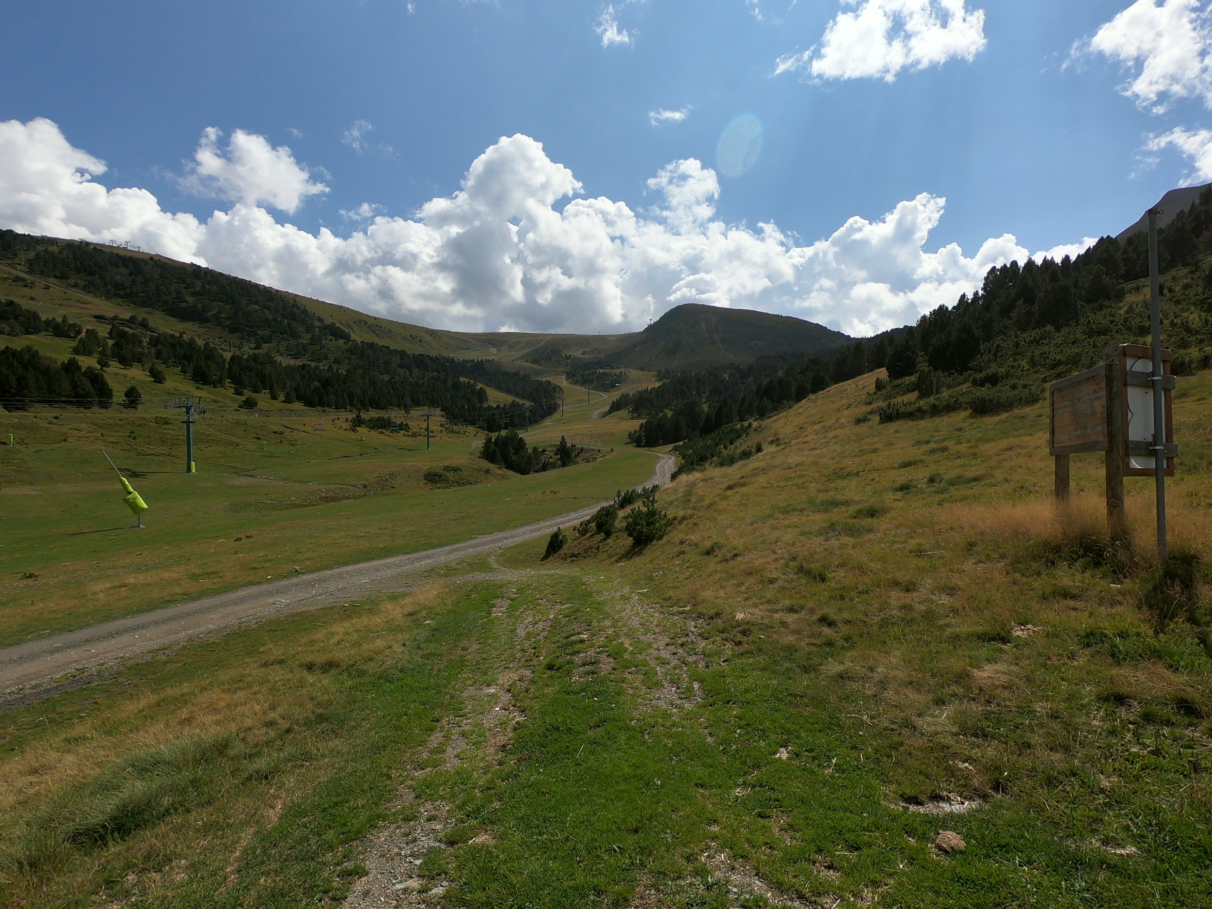
At the refuge, the trail goes downhill for a short distance until the gravel road, then turns right. The race finishes to the right of the dark hump/mountain/hill in the middle of this photo.

The gravel road. This is at a different ski resort to the ski resort we ran past at about halfway into the race.

Just past the refuge, leave the gravel road and run on the grass up to the right. It is hard to tell, but we are aiming for the green path just to the left of the trees.
Follow the red triangular flags straight up and to the right.

The author/photographer, Matt Setlack standing on one of the steepest sections of the entire race course.

Continue up the grass ski slope. The grass is long and the trail is faint but I think it will be well marked on race day.

The course flattens out here.
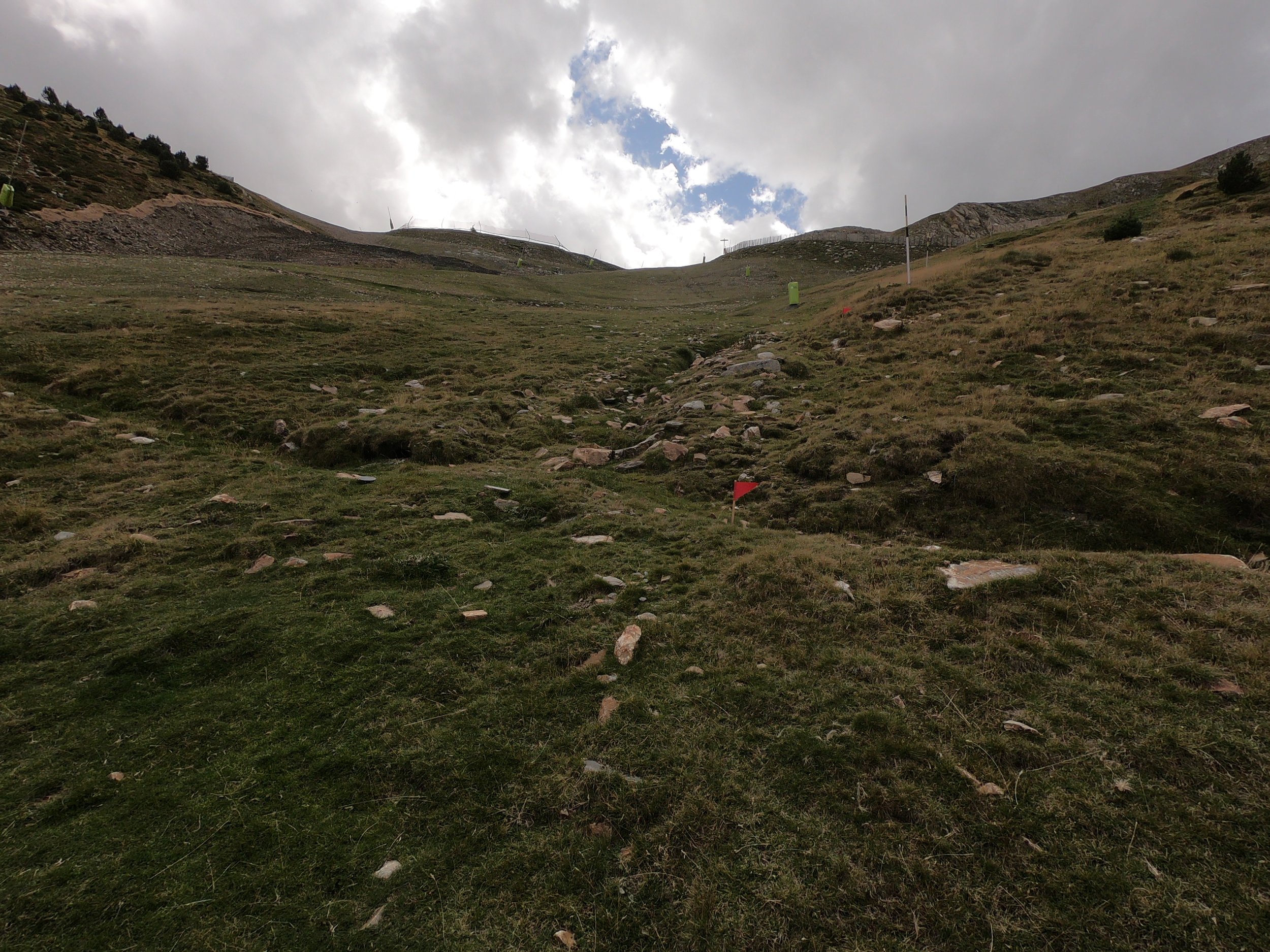
A steep section a few hundred meters before crossing the gravel road.

Cross over a small trench, then cross the gravel road. We are aiming for the grass on the inside of the turn. We go around the far side of the far fence.

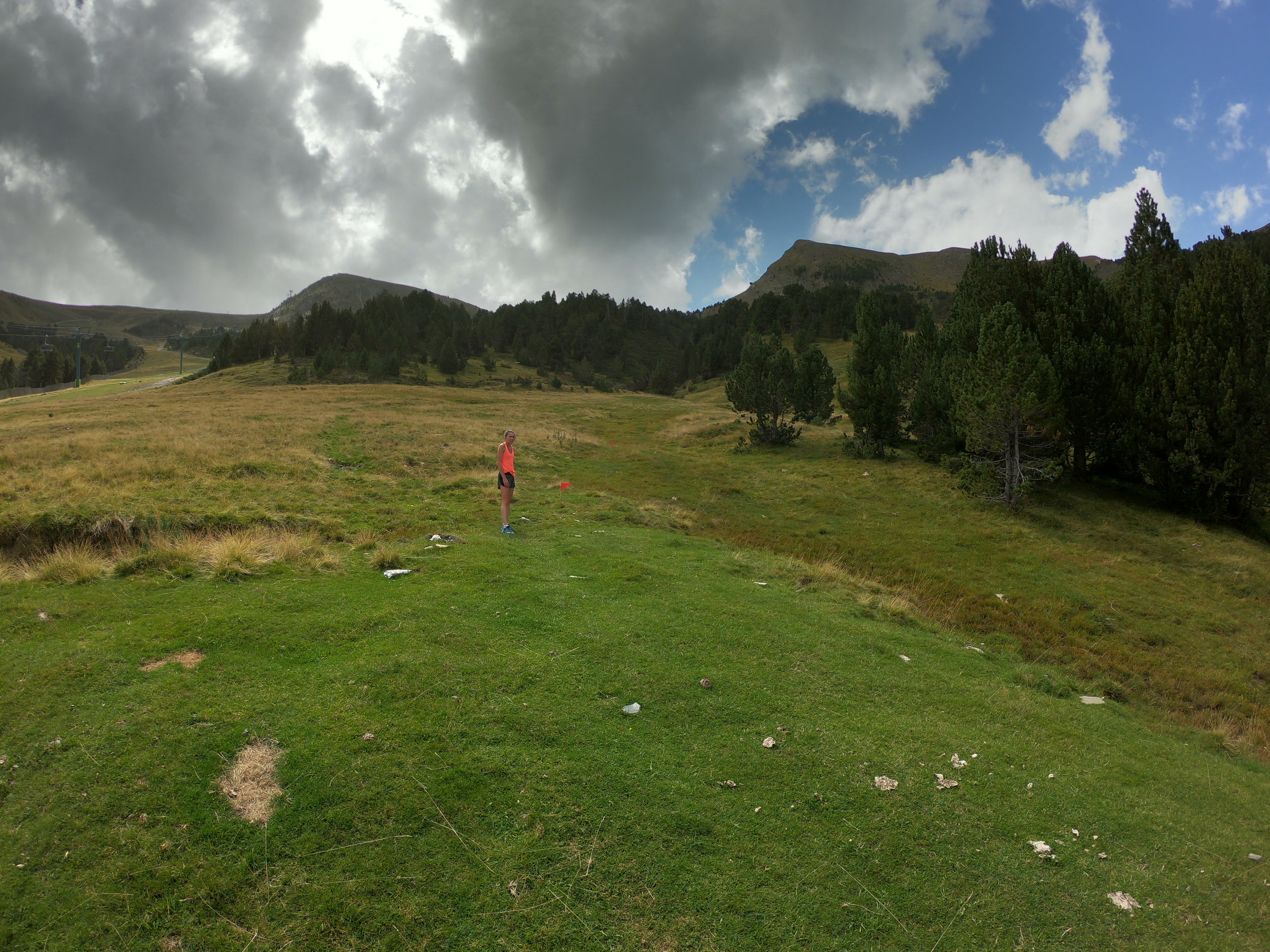
Around 10.8 km or so.

About 11 km into the race. Less than 1 km to the finish line. The course goes up and to the right and parallels the ski lift that we see in this photo. From here until the race at 11.93 km (2,430m ASL), it is relatively flat.
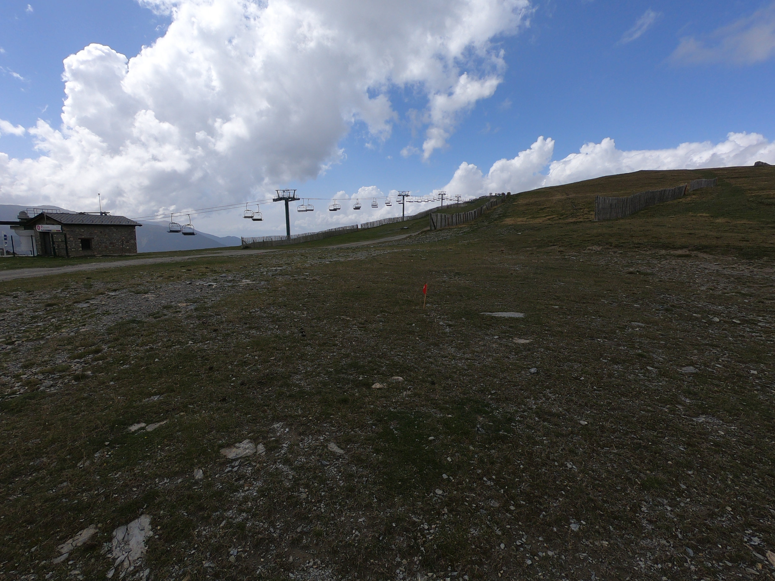
The red flags mark the way. Run straight ahead, cross over the road and then bend to the right (uphill) nearly underneath the chairlift.

The red flags show us going uphill along the fence on the left (not on the gravel road). We run nearly underneath the chairlift. This is about 11 km into the race.
I hope you enjoyed the photos and short descriptions. If you have any questions, feel free to email me using the "contact" button above.
Good luck to all racers competing in the World Mountain Running Championships 2018!